In the modern construction, property, and development sectors, access to highly accurate data is the foundation of successful project management. At SEQ Drone Inspections, we provide professional aerial mapping and surveying solutions that turn complex physical sites into clear, actionable digital models.
Using advanced drone technology, we capture high resolution imagery and precise measurements of your site, allowing you to make informed decisions without the safety risks or high costs of traditional ground crews.
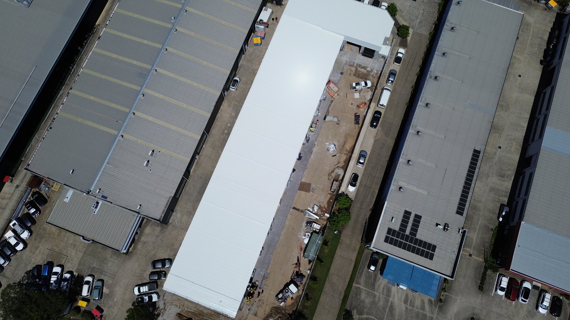
Whether you need to track site progress, create visual documentation, or generate basic 3D models, our team delivers the data you need, faster.

CASA Certified
Licensed commercial drone operators with full certification
$10M Insured
Comprehensive public liability insurance for your peace of mind
Fast Turnaround
Quick data capture and delivery to keep projects on schedule
What is Aerial Mapping Used For?
Aerial mapping is distinct from standard drone photography. It is the process of using drone photogrammetry to create geometrically corrected images, known as orthomosaics, that can be used to measure true distances and areas.
This technology is essential for industries that require frequent, reliable updates on their site conditions. By converting aerial imagery into 2D maps and basic 3D models, we help clients across SEQ visualize their projects with absolute clarity.
Construction
Monitor earthworks and track site progress with visual documentation
Urban Planning
Detailed mapping of land for development applications
Land Development
Create high resolution imagery to assess land potential
Environmental Monitoring
Manage vegetation growth and erosion change over time
The Benefits of Professional Drone Mapping
Choosing a professional aerial survey over manual ground methods offers significant advantages. Our drone mapping services are designed to reduce downtime and keep your team out of harm's way.
Speed and Efficiency
Traditional surveying can take days or weeks to complete. We can capture data for large sites in a matter of hours. This means you get the information you need to keep your projects on schedule.
High-Quality Imagery
We deliver high resolution imagery that allows you to zoom in on fine details, ensuring no point of interest is missed during the planning phase.
Enhanced Safety
Walking dangerous terrain puts staff at risk. Our pilots operate from a safe location, ensuring access to hazardous areas is achieved without liability issues.
Our Aerial Survey Process
We have refined our workflow to ensure simple and fast delivery for our customers.
Consultation
We discuss the specific areas you need covered and the level of detail required.
Data Capture
Our licensed experts fly the site using state-of-the-art drones to capture high-resolution imagery.
Processing
We use powerful software for data processing, creating seamless maps and basic 3D models where needed.
Delivery
You receive the complete dataset, ready to view on your preferred platform or in the office.
Industries We Serve in SEQ
Our expertise spans multiple industries. We understand that each sector has different requirements for visual documentation and mapping.
Civil Construction
Track progress and maintain a date-stamped visual history of the job.
Land Development
Create compelling high resolution imagery to assess land potential.
Environmental Monitoring
Manage vegetation growth and erosion change over time.
Property Development
Visual documentation and basic 3D models for planning applications.
How Much Does Aerial Mapping Cost?
Cost is a major factor in decision making. While traditional land surveying can be expensive, drone mapping is a cost-effective alternative.
Pricing varies based on the size of the location, the complexity of the terrain, and the specific deliverables required (such as basic 3D models vs. 2D orthomosaics). However, by drastically reducing the time on site, we offer a solution that fits most project budgets.
Contact us today for a free quote. We can provide a custom plan that gives you access to high-quality data without the premium price tag.
Why Choose SEQ Drone Inspections?
We combine years of piloting experience with a deep understanding of surveying principles. We are fully licensed (ReOC) and insured, ensuring every flight is compliant with Australian aviation regulations.
Best Tools
We use high-quality equipment to ensure you get great results every time
Licensed & Insured
Fully CASA certified with $10M public liability insurance
Local Expertise
Deep knowledge of South East Queensland sites and conditions
Complete Service
We handle everything from data capture to final delivery